

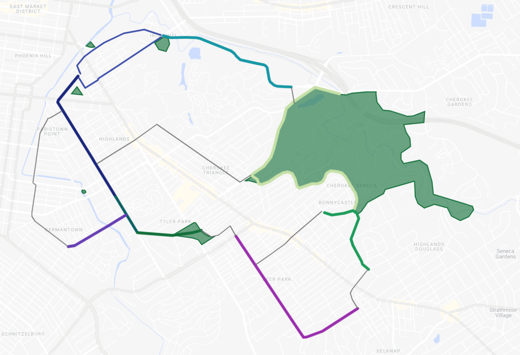
The Proposal: a network of 8 two-way protected mobility lanes connecting the Highlands and adjacent neighborhoods, along with a Cherokee Greenway for improved access into Cherokee Park.
The Vision: Easy, convenient routes to access amenities across the Highlands, with direct connections to Cherokee and smaller neighborhood parks. Safe and accessible to people of all ages and abilities.
The Proposed Routes:
- Barret 1.0 :: Rufer Ave to Castlewood Ave (completed 2019)
- Castlewood :: Barret Ave to Tyler Park (completed 2019)
- Norris/Douglass :: Eastern Pkwy to Bardstown Rd
- Ellison :: Spratt St to Barret Ave
- Spring :: Woodford Pl to Bonnycastle Ave
- Barret 2.0 :: Rufer Ave to Rubel Ave
- Lexington 2.0 :: Payne St to Etley Ave
- (a) Lexington 3.0 or (b) Payne :: Rubel/Barret to Lexington/Payne
Where We Stand Today:
- Barret 1.0 and Castlewood were implemented in Summer 2019, after a proposal from S4P in 2015.
- S4P is currently in discussions with Louisville Metro Government regarding Norris/Douglass and Ellison.
- In May 2022, S4P distributed a public survey and held a public meeting on the Norris/Douglass proposal.
- S4P is planning a similar engagement process for Ellison in Summer 2022.
- S4P introduced the Greater Highlands Mobility Network in June 2022. This proposal includes four additional mobility lanes (Barret 2.0, Spring, Lexington 2.0, and Lexington 3.0/Payne) and the Cherokee Greenway.